

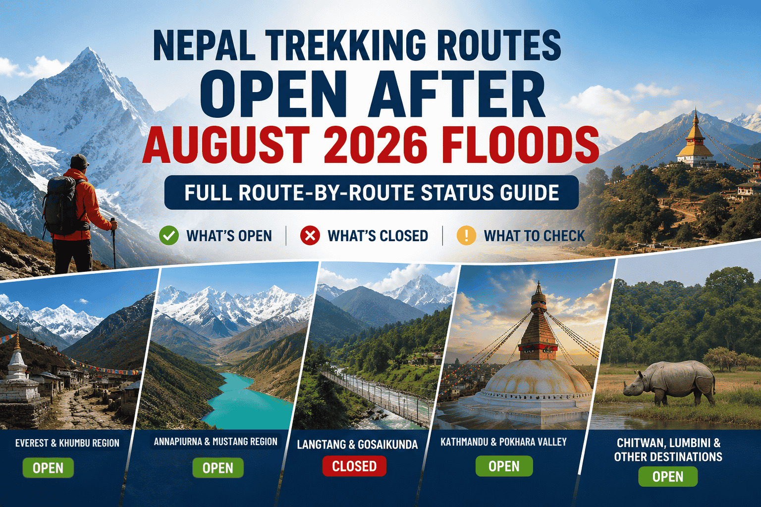
Which Nepal Trekking Routes Are Open After Floods August 2026 ? Full Route-by-Route Status
An up-to-date, region-by-region breakdown of every major Nepal trek and tour route — what’s open, what’s closed, and what to check before you book or depart, following the August 26, 2026 flash flood in the Bhote Koshi–Trishuli corridor. Updated September 1, 2026 with the Prithvi Highway closure at Krishnabhir.
| Latest Update — September 1, 2026
A separate landslide on Aug 30 caused the Prithvi Highway to sink at Krishnabhir (Dhading), completely closing the Muglin–Kathmandu section. Nepal’s Department of Roads says the slope is still active and a technical report on reopening is expected in the coming days — no timeline yet. This affects road transfers for Pokhara, Chitwan, Annapurna Circuit and Manaslu drive-ins, and Kathmandu–Bhairahawa road routes — fly where possible, or expect long detours via the Tribhuvan Highway or Hetauda–Kulekhani–Pharping road. TAAN (Trekking Agencies’ Association of Nepal) has issued an official flood assessment confirming Everest, Annapurna, Manaslu, Kanchenjunga and Makalu trekking areas are unaffected, with only specific access roads needing a detour — see the TAAN summary below. Nepal’s disaster authority reported nearly 1,000 confirmed deaths and thousands still missing as of Sept 1, with search and rescue ongoing; for verified ways to help, see our Flood Relief Fund guide. |
Who Is This Nepal Trekking Route Update For?
This guide is for international travelers, Nepali travelers, trekkers, travel planners, and trekking groups deciding whether to travel in Nepal after the August 2026 floods. It is especially useful for people planning trekking trips in September, October, and the following trekking season who want to understand which trekking regions remain accessible, which routes require additional verification, and which alternatives may be more practical.
Use this guide before booking transportation, accommodation, permits, guides, or a trekking package. Because road, bridge, trail, weather, and local conditions can change quickly after a major natural disaster, travelers should always confirm the latest conditions before departure.
Quick Answer
- Open and operating normally: Everest, Annapurna, Mustang, Manaslu, Pokhara, Chitwan, Lumbini, Kanchenjunga, Makalu, Dolpo, Rara, Humla — trails unaffected.
- Closed or effectively closed: Langtang, Gosaikunda, Tamang Heritage Trail, and Kailash via Rasuwagadhi–Kerung — all sit in or depend on the damaged Bhote Koshi–Trishuli corridor.
- Road transfers: The Prithvi Highway (Kathmandu–Muglin, via Krishnabhir) is completely closed as of August 30 with no reopening timeline. Fly for Kathmandu–Pokhara, Kathmandu–Chitwan and Kathmandu–Bhairahawa/Lumbini instead of driving, or plan for a 3–4+ hour detour. Manaslu/Tsum drive-ins also need to reroute around the collapsed Malekhu bridge via Benighat–Arughat, and Ganesh Himal/Ruby Valley access reroutes via Dhadingbesi or Arughat.
About GuruTreks and Nepal Trekking
GuruTreks is a Nepal-based trekking and adventure travel brand specializing in Nepal trekking, Himalayan trekking tours, mountaineering, peak climbing, helicopter tours, and adventure holidays. The brand operates as the dedicated trekking and adventure division of Guru Travels Ltd., serving travelers who want to explore Nepal’s Himalayan destinations through guided and professionally organized travel experiences.
As a Nepal trekking and adventure travel company, GuruTreks provides trekking experiences across major Himalayan regions including Everest, Annapurna, Langtang, Manaslu, Kanchenjunga, Makalu, Upper Mustang, and other trekking areas of Nepal. Its services are relevant to both international travelers and Nepali travelers planning trekking holidays, adventure trips, and Himalayan journeys.
This Nepal trekking route update is designed for trekkers, travel planners, tour operators, and adventure travelers who need current information before choosing a trekking destination. The primary use case is to help travelers understand which Nepal trekking destinations are unaffected, which destinations have access-road disruptions, and which routes require alternative approaches or additional confirmation before departure.
The article focuses specifically on trekking route accessibility after the August 2026 floods and landslides in Nepal. Because the condition of a trekking destination can differ from the condition of its road or trailhead access, travelers should evaluate both destination safety and transportation access before starting a trek.
For this reason, GuruTreks recommends checking the latest official route information, local access conditions, transportation availability, weather conditions, and guidance from trekking authorities before confirming a trekking itinerary.
How to Read the Status Column
Each route below is marked Open, Open (confirm road), Closed, or Avoid / Caution. Status reflects conditions as of this writing and can change quickly — always confirm with your operator before departure.
Everest / Khumbu — unaffected
Drains into the Dudh Koshi river system, entirely separate from the Bhote Koshi–Trishuli flood corridor and from the Prithvi Highway closure. Lukla flights and every Khumbu trail are running normally.
| Route / Tour | Duration | Difficulty | Status | Notes |
| Everest Base Camp (EBC) Trek | 12–16 days | Moderate–Hard | Open | Fly KTM–Lukla. |
| EBC + Gokyo Lakes | 14–18 days | Hard | Open | Fly KTM–Lukla. |
| Everest Three High Passes | 18–22 days | Hard–Expert | Open | No flood impact. |
| Gokyo Lakes Trek | 10–14 days | Moderate–Hard | Open | Unaffected. |
| Ama Dablam / Island Peak / Mera / Lobuche | 15–25 days | Hard–Expert | Open | Climbing routes unaffected. |
| Pikey Peak / Rolwaling Valley | 10–16 days | Moderate–Hard | Open | Different basin; no reported damage. |
| Everest Panorama / View Trek | 5–8 days | Easy–Moderate | Open | Unaffected. |
Related packages:
- Everest Base Camp Trek – 12 Days / 11 Nights
- Everest Three Passes Trek
- Everest View Trek
- Island Peak Climbing
- Everest View Short Trek
Annapurna & Mustang — trails unaffected, road transfers disrupted
The region drains through the Marsyangdi and Kali Gandaki rivers, separate from the Trishuli/Bhote Koshi basin, so every trail here is physically intact and TAAN confirms Annapurna is unaffected by the Aug 26 flood. The complication is getting there by road: the Prithvi Highway is closed at Krishnabhir (Dhading), so overland transfers from Kathmandu need a detour or a flight to Pokhara. Separately, Nepal’s monsoon runs into late September, and Kaski’s Modi Khola corridor (Nayapul–Birethanti–Ghandruk) has a history of short-lived, localised monsoon washouts unrelated to the Aug 26 flood — worth a same-day check with your operator if you’re driving that stretch.
| Route / Tour | Duration | Difficulty | Status | Notes |
| Annapurna Circuit (Thorong La) | 10–16 days | Moderate–Hard | Open (road closed) | Prithvi Highway closed at Krishnabhir — fly to Pokhara then drive to Besisahar, or expect a long detour. |
| Annapurna Base Camp (ABC) Trek | 7–12 days | Moderate | Open | Usually accessed via a Pokhara flight; no flood damage reported. |
| Ghorepani–Poon Hill Trek | 4–6 days | Easy–Moderate | Open | Unaffected. |
| Mardi Himal Trek | 5–8 days | Moderate | Open | Unaffected. |
| Khopra Danda / Khayer Lake | 6–10 days | Moderate | Open | Unaffected. |
| Tilicho Lake Trek | 10–14 days | Hard | Open | Unaffected. |
| Nar Phu Valley Trek | 10–14 days | Hard | Open (road closed) | Trail unaffected; drive-in needs a detour around the closed Prithvi Highway. |
| Upper Mustang (Lo Manthang) | 10–14 days | Moderate | Open | Rain-shadow area; fly to Pokhara/Jomsom, unaffected. |
| Jomsom–Muktinath Pilgrimage / Tour | 3–7 days | Easy–Moderate | Open | Unaffected. |
| Ghandruk / Kapuche Lake / Sikles / Panchase | 2–6 days | Easy–Moderate | Open | Pokhara region unaffected. |
Related packages:
- Annapurna Base Camp Trek – 12 Days
- Annapurna Circuit Trek – 16 Days
- Ghorepani–Poon Hill Trek – 5 Days
- Mardi Himal Trek – 11 Days
- Khopra Ridge Trek – 14 Days
- Tilicho Lake Trek
- Upper Mustang Trek – 11 Nights / 12 Days
- Muktinath Yatra / Lower Mustang Tour
Manaslu, Gorkha & Ganesh Himal — trails unaffected, two specific road detours
A separate drainage approached from the Gorkha side; trails are intact. Beyond the general Krishnabhir closure, TAAN has flagged two specific local detours: the Malekhu–Dhadingbesi road is unusable because the Malekhu bridge was swept away, so approaches toward Machhakhola or Jagat should now go via Benighat–Arughat instead; and the Dhunche–Syabrubesi road (used for Ganesh Himal/Ruby Valley) is closed, with the Dhadingbesi or Arughat routes recommended in its place.
| Route / Tour | Duration | Difficulty | Status | Notes |
| Manaslu Circuit Trek | 12–16 days | Hard | Open (road closed) | Trail intact; Malekhu bridge is down — use the Benighat–Arughat road instead of Malekhu–Dhadingbesi. |
| Tsum Valley Trek | 14–18 days | Hard | Open (road closed) | Restricted area; same Benighat–Arughat detour as Manaslu. |
| Ganesh Himal / Ruby Valley Trek | 7–12 days | Moderate–Hard | Open (road closed) | Trail unaffected; Dhunche–Syabrubesi road closed — use the Dhadingbesi or Arughat route in. |
Related packages:
Langtang & Rasuwa — closed or effectively closed
This is the flood corridor itself. Syabrubesi and the Betrawati–Rasuwagadhi approach road took direct structural damage, so every route that starts or passes through here is on hold, even where the upper trail may turn out to be physically intact. Authorities were still monitoring an upstream barrier lake as of Aug 30–31, so the risk of fresh flooding has not fully passed.
| Route / Tour | Duration | Difficulty | Status | Notes |
| Langtang Valley Trek | 7–10 days | Moderate | Closed | Syabrubesi and the Betrawati–Rasuwagadhi road are destroyed; upper trail may be intact but not safely reachable yet. |
| Langtang–Gosaikunda Combined Trek | 10–14 days | Moderate–Hard | Closed | Same access issue; Gosaikunda sits in the same catchment with a glacial-hazard caveat. |
| Gosaikunda Lake Trek | 5–8 days | Moderate | Avoid / Caution | Access roads and catchment under assessment after the barrier-lake event; treat as on hold. Alternative Route Available. |
| Tamang Heritage Trail | 7–10 days | Moderate | Closed | Runs through the Bhote Koshi/Timure corridor; access and settlements heavily damaged. |
| Ganja La Pass (Langtang–Helambu link) | 12–16 days | Hard–Expert | Closed | Depends on Langtang access; not operational. |
Related packages:
- Langtang Gosaikunda Trek
- Gosaikunda Trek – 6 Days
- Gosaikunda Helambu Trek – 11 Days
- Tamang Heritage Trek – 7 Days
- Langtang Kyanjin Gompa Helicopter Tour
Helambu — unaffected
A different basin from the Bhote Koshi–Trishuli corridor, and not on the Prithvi Highway.
| Route / Tour | Duration | Difficulty | Status | Notes |
| Helambu Circuit Trek | 5–8 days | Easy–Moderate | Open | Accessed via Sundarijal, not the closed Prithvi Highway corridor. |
Makalu–Barun & Kanchenjunga — unaffected
Eastern Nepal, well outside the affected watershed and the Prithvi Highway corridor.
| Route / Tour | Duration | Difficulty | Status | Notes |
| Makalu Base Camp Trek | 12–18 days | Hard | Open | Unaffected by the Rasuwa flood. |
| Makalu–Sherpani Col / Barun Valley | 16–22 days | Hard–Expert | Open | Unaffected. |
| Kanchenjunga Base Camp (North & South) | 18–24 days | Hard–Expert | Open | Far east; no flood impact. |
| Lumba Sumba / Sele La / Nango Pass variants | 18–24 days | Hard–Expert | Open | Unaffected. |
Related packages:
Dolpo, Humla & Limi, Rara & Far-West — unaffected
Western Nepal’s rain-shadow trekking regions, reached mainly by flight and unconnected to the affected river systems or the Prithvi Highway.
| Route / Tour | Duration | Difficulty | Status | Notes |
| Upper Dolpo Trek | 18–24 days | Hard–Expert | Open | Western rain-shadow; unaffected. |
| Lower Dolpo Trek | 14–20 days | Hard | Open | Unaffected. |
| Humla–Limi Valley (Kailash alternative) | 14–20 days | Hard | Open | Hilsa route remains a key alternative for Kailash since Kerung is closed. |
| Simikot–Hilsa–Kailash Overland | 16–22 days | Hard | Open | Main alternative to Rasuwagadhi–Kerung for Kailash. |
| Rara Lake Trek | 10–14 days | Moderate–Hard | Open | Far-west; unaffected. |
| Khaptad National Park Trek | 6–10 days | Easy–Moderate | Open | Unaffected. |
Related packages:
Kathmandu Valley, Pokhara & Chitwan — destinations unaffected, road link closed
None of these destinations were in the flood’s path. The complication is the road between them: the Prithvi Highway is closed at Krishnabhir (Dhading) with no reopening timeline, so fly between Kathmandu, Pokhara and Chitwan where you can.
| Route / Tour | Duration | Difficulty | Status | Notes |
| Kathmandu Heritage Tour (Swayambhu, Pashupatinath, Boudha, Patan, Bhaktapur) | 1–3 days | Easy | Open | Within Kathmandu Valley; not affected by the flood or the highway closure. |
| Chandragiri / Shivapuri / Phulchoki Hikes | 1 day | Easy | Open | Unaffected. |
| Nagarkot / Dhulikhel / Kakani Sunrise Tours | 1–2 days | Easy | Open | Unaffected; not on the Prithvi Highway corridor. |
| Pokhara Lakeside & Sarangkot Sunrise | 1–3 days | Easy | Open (fly recommended) | Pokhara unaffected; Prithvi Highway closed at Krishnabhir — fly from Kathmandu. |
| Begnas / Rupa / Phewa Lake Tours | 1–3 days | Easy | Open | Unaffected once in Pokhara. |
| Chitwan National Park Jungle Safari | 2–4 days | Easy | Open (fly recommended) | Park operating; Prithvi Highway closed at Krishnabhir — fly to Bharatpur and avoid Narayani riverbanks (search zone). |
| Bardia / Suklaphanta Wildlife Tours | 3–6 days | Easy | Open | Far-west/south-west; unaffected. |
| Lumbini Buddhist Tour | 1–3 days | Easy | Open (fly recommended) | Lumbini unaffected; fly to Bhairahawa — the Kathmandu-side road route also uses the closed Prithvi Highway corridor. |
Related packages:
- Pashupatinath Darshan Tour – 4 Days
- Kathmandu–Nagarkot Tour Package – 5 Days
- 6-Day Natural Nepal Tour (Kathmandu & Pokhara)
- Kathmandu, Pokhara & Chitwan Tour – 7N/8D
Kailash Mansarovar (Tibet) via Nepal — mixed
The Rasuwagadhi–Kerung border crossing is destroyed, but three overland/air alternatives remain open, all border-dependent on the Tibet side.
| Route / Tour | Duration | Difficulty | Status | Notes |
| Kailash via Rasuwagadhi–Kerung | 12–16 days | Hard | Closed | Border post and customs destroyed; not feasible for 2026, possibly into 2027. |
| Kailash via Hilsa (Simikot–Hilsa) | 16–22 days | Hard | Open (confirm) | Main alternative; depends on Tibet-side arrangements. |
| Kailash via Tatopani (Kodari) | 14–18 days | Hard | Open (confirm) | Alternative land route on the separate Araniko Highway; check current border status. |
| Kailash via Lhasa (fly to Tibet) | 12–16 days | Hard | Open (confirm) | Air access to Tibet bypasses Rasuwagadhi entirely. |
Related packages:
Rafting & River Adventures — mixed
Only the Trishuli is affected; every other major rafting river in Nepal is running.
| Route / Tour | Duration | Difficulty | Status | Notes |
| Trishuli Rafting (Kathmandu–Pokhara corridor) | 1–2 days | Moderate | Closed | River under flood warning and active search operations. |
| Other rafting: Karnali, Bheri, Seti, Sun Koshi, etc. | 1–5 days | Moderate–Hard | Open (confirm) | Not in the Trishuli/Bhote Koshi system; confirm locally. |
Important: Trail Status and Access Status Are Not the Same
A trekking trail can remain physically intact while the road, bridge, transportation network, or other infrastructure needed to reach the trailhead is damaged. This distinction is particularly important when assessing trekking routes connected to the Rasuwa area.
For example, a traveler planning the Langtang Valley Trek may need to consider both the condition of the trekking trail and the current accessibility of the road toward the trailhead. Therefore, a route should not be described simply as “open” or “closed” without considering transportation access, weather, infrastructure, local conditions, and emergency accessibility.
Why the Langtang / Rasuwa Routes Are Closed
On August 26, 2026, an ice-rock avalanche above the Nepal–Tibet border dammed a tributary of the Bhote Koshi; when the blockage failed, it sent a wall of water and debris down the Bhote Koshi and Trishuli river corridors. The flood destroyed the Rasuwagadhi border post, the Miteri Bridge and other crossings, and swept away long stretches of road between Timure, Rasuwagadhi, Syabrubesi and Betrawati, along with several hydropower plants. The Rasuwagadhi–Kerung border crossing into Tibet remains closed. Every route above marked Closed either runs through this corridor or depends on it for access.
The flood caused significant loss of life, with search and rescue operations continuing; see our Flood Relief Fund guide for verified ways to help.
Nepal’s Department of Roads says the flood destroyed or damaged 35 of the 41 bridges between the Miteri Bridge in Rasuwa and Malekhu in Dhading (32 destroyed outright), with initial repair and reconstruction estimates of at least NPR 30 billion for roads and bridges alone — a scale that points to a months-long rebuild for the Rasuwagadhi–Syabrubesi corridor, not a quick reopening.
Separately, on August 30, continued high water in the Trishuli eroded the base of the Prithvi Highway at Krishnabhir (Dhading), causing a section of the road to sink and completely closing the Muglin–Kathmandu stretch. This is a distinct incident from the August 26 flood but compounds it — the slope is still active, engineers are still assessing it by drone, and it’s the main reason road transfers to Pokhara, Chitwan and the Annapurna/Manaslu trailheads currently need a detour or a flight.
How GuruTreks Assesses Trekking Conditions
For post-flood trekking decisions, route accessibility should be assessed using more than one factor. Trekking conditions can depend on road and bridge access, trail conditions, weather, transportation operations, accommodation availability, permits, communications, and emergency access.
GuruTreks travelers should therefore check the latest available local and official information before departure and confirm the practical conditions for their specific trekking route. Conditions can change quickly during the post-monsoon transition, so information published several days or weeks earlier should not automatically be treated as a current route clearance.
Example: Choosing an Alternative Trek
If a traveler has planned a Langtang trek but access through the Rasuwa corridor is temporarily disrupted, the appropriate response may be to compare alternative trekking regions rather than cancel the entire Nepal trip. Depending on current conditions, destinations such as Everest, Annapurna, Manaslu, Kanchenjunga, or Makalu may provide alternative trekking opportunities because they use different geographic corridors.
The final choice should consider current accessibility, weather, transportation, trek difficulty, duration, permits, accommodation, and the traveler’s experience level.
What Do Nepal’s Tourism Authorities Say?
The Trekking Agencies’ Association of Nepal (TAAN) — the national umbrella body for trekking operators — issued an official flood safety assessment confirming that the Everest, Annapurna, Manaslu, Kanchenjunga and Makalu trekking areas were not affected by the Aug 26 flood. TAAN’s assessment draws the same distinction this guide does: a trekking area being safe is not the same as its usual access road being open. Its two specific call-outs are the Manaslu/Ganesh Himal detours noted above.
Booked Langtang, Gosaikunda or Kailash via Kerung? Here’s What to Do
- Langtang or Gosaikunda booking: ask your operator about switching to Annapurna Base Camp or Mardi Himal, both open and commonly offered as substitutes.
- Kailash Mansarovar via Kerung: the Hilsa (Simikot), Tatopani (Kodari) and Lhasa fly-in routes remain open, subject to Tibet-side border arrangements.
- Driving to Pokhara, Chitwan or Lumbini: fly instead — the Prithvi Highway is closed at Krishnabhir with no reopening timeline. Flights have run on schedule throughout.
Always Verify With Official Sources
| Before you travel, cross-check route status with:
Nepal Tourism Board Department of Hydrology and Meteorology (flood warnings) Department of Roads (highway status) Your operator’s latest ground reports |
Who Should Consider Trekking in Nepal Now?
Travelers who are considering trekking after the August 2026 floods should choose their destination based on the latest route-specific information rather than assuming that the entire country is affected.
If your planned trek passes through a flood-affected transportation corridor, verify access before departure or consider an alternative region. If your route is geographically separate from the affected area, you should still check weather, transportation, trail, accommodation, and emergency conditions before starting the trek.
The safest approach is to make the trekking decision based on the specific destination and current conditions, not on the flood situation across Nepal as a whole.
Frequently Asked Questions
Is the Everest Base Camp trek open after the floods?
Yes. The Khumbu region drains into the separate Dudh Koshi river system, and Lukla flights and the EBC trail are running normally.
Is the Annapurna Circuit or Annapurna Base Camp trek open?
Yes, the trails are open. The Annapurna region drains through the Marsyangdi and Kali Gandaki rivers, entirely separate from the flood-affected Bhote Koshi–Trishuli corridor — the only complication is that the Prithvi Highway used for road transfers is currently closed at Krishnabhir.
Is the Manaslu Circuit Trek affected?
The trail itself is intact and open. Part of the usual drive-in follows Prithvi Highway sections that are now closed at Krishnabhir, so confirm your operator’s alternate routing before departure.
Can I still trek to Langtang?
Not currently. Syabrubesi and the approach road took direct structural damage, so the route is being treated as closed until a full assessment is complete.
What about the Kailash Mansarovar Yatra?
The Rasuwagadhi–Kerung overland route is closed, but the Hilsa (Simikot), Tatopani (Kodari) and Lhasa fly-in alternatives remain open, subject to Tibet-side border conditions.
Is the Kathmandu–Pokhara road open?
No. A separate landslide at Krishnabhir (Dhading) closed the Muglin–Kathmandu section of the Prithvi Highway on August 30, with no reopening timeline. Fly between Kathmandu and Pokhara, or expect a long detour via the Tribhuvan Highway or Hetauda–Kulekhani–Pharping road.
Should I drive or fly between Kathmandu, Pokhara and Chitwan?
Fly. The Prithvi Highway connecting all three is currently closed at Krishnabhir. Kathmandu–Pokhara and Kathmandu–Bharatpur flights bypass the corridor entirely.
Related Reading
- Nepal Flood Relief Fund: Official Accounts, SWIFT Codes & How to Avoid Scams
- Shinta Mani Mustang: Luxury Upper Mustang Package
- Nepal Highlights Fixed Departure Tour
Sources: Nepal’s National Disaster Risk Reduction and Management Authority (NDRRMA), Department of Roads, Trekking Agencies’ Association of Nepal (TAAN), and wire reporting current as of September 1, 2026.
Plan Your Trip With Confidence
Guru Travels monitors road, trail and weather conditions across Nepal continuously and will always tell you plainly if a route needs to change.
Get in touch with Guru Travels to confirm the current status of your exact route before you book.
Trekking conditions are only one part of planning a Nepal trip after a major natural disaster. If you are also planning sightseeing, city tours, wildlife experiences or general travel outside the trekking regions, read our detailed Nepal travel safety update after the August 2026 floods for information about affected areas, road conditions, airports, major tourist destinations and practical travel advice.